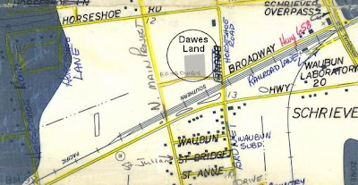
1973 Flood Map.
The Dawes Land is 12 feet above sea level.
2005 9/25 Rita Floodmap
More interesting is the map of the flooding that came with Hurricane Rita, the one that followed Katrina. This one is apparently made from an aerial photograph. Click for a larger view.
Conclusion
Apparently VERY LITTLE DAMAGE. I haven't heard from local residents, but Morgan City did not get serious flooding. The Bonnet Carre was opened early. The Morganza Spillway was opened about 1/3. The Atchafalaya flooding was minimal... apparently the land was very dry and absorbed the worst.

